Met up with fellow VK1 SOTA activators Al, VK1RX, Andrew, VK1NAM and Andrew VK1DA/2UH for dinner at Manuka, where we discussed many SOTA things.
After dinner went to the Canberra Region Amateur Radio Club (CRARC) meeting in Red Hill for a presentation of SOTA operating by Andrew, VK1NAM. Took my SOTA gear along as part of a display during the talk to show what equipment is used. Generated interest from club members.
At the end of the talk Andrew surprised me with a presentation of a VK1 Shack Sloth Award!
A close up of the award at home
A happy looking Shack Sloth :)
Ordered the official one from the SOTA shop online, probably take a few weeks to arrive via the post from the UK.
A blog about Amateur Radio callsign VK1DI Ian's activities on the Amateur Radio bands, mostly Summits On the Air (SOTA) and World Wide Flora and Fauna (WWFF) portable activities.
Thursday, 27 June 2013
Saturday, 15 June 2013
SOTA Activation of The Devil's Peak VK5/NE-080
After an overnight stay at Port Augusta drove almost to Quorn, then turned off onto some unsealed roads leading to The Devil's Peak
The road comes to a gate of a farm, private property, however the owner has granted access for those doing the walk.
The road ends in a car park for the walk.
A sign at the start of the walk indicates about 2.6 Km long. My GPS showed about a Km direct to the peak.
The track started off easy at first, wandering through the bush.
Nearing the peak it got steep and rocky. There were red arrow signs on trees to guide you, plus distance markers from the car park. Got to a saddle in the range and went left.
Around the corner was a narrow canyon between 2 huge rocky outcrops. There was a hard way up
And and easy way
I took the easy way. The views on top were fantastic! Looking North to Quorn
Looking South to the summit and Port Augusta. It was obvious that operating right from the summit would require nerves of steel, which I didn't have...not to mention where do you mount a squid pole and dipole!
I measured the top as 710 m, so dropped back down the slope to the 700 m mark to stay in the 25 m activation zone. I used the stump of a small tree to support the squid pole.
The 20m/40m antennas looped under some rocks. View looking up the slope
View looking down. Quite impressive. The Dutchman's Stern is on the right.
Got on 40 m, made 14 contacts including an S2S with Andrew VK1NAM on VK1/AC-020 Mt Domain. Tried 20 m, also worked Andrew there as well, my first S2S on 20 m! Packed up and headed to Quorn for lunch, then on to Wilpena Pound for the night.
FYI, this activation places me with over 100 Activator points!
The road comes to a gate of a farm, private property, however the owner has granted access for those doing the walk.
The road ends in a car park for the walk.
A sign at the start of the walk indicates about 2.6 Km long. My GPS showed about a Km direct to the peak.
The track started off easy at first, wandering through the bush.
Nearing the peak it got steep and rocky. There were red arrow signs on trees to guide you, plus distance markers from the car park. Got to a saddle in the range and went left.
Around the corner was a narrow canyon between 2 huge rocky outcrops. There was a hard way up
And and easy way
I took the easy way. The views on top were fantastic! Looking North to Quorn
Looking South to the summit and Port Augusta. It was obvious that operating right from the summit would require nerves of steel, which I didn't have...not to mention where do you mount a squid pole and dipole!
I measured the top as 710 m, so dropped back down the slope to the 700 m mark to stay in the 25 m activation zone. I used the stump of a small tree to support the squid pole.
The 20m/40m antennas looped under some rocks. View looking up the slope
View looking down. Quite impressive. The Dutchman's Stern is on the right.
Got on 40 m, made 14 contacts including an S2S with Andrew VK1NAM on VK1/AC-020 Mt Domain. Tried 20 m, also worked Andrew there as well, my first S2S on 20 m! Packed up and headed to Quorn for lunch, then on to Wilpena Pound for the night.
FYI, this activation places me with over 100 Activator points!
Thursday, 13 June 2013
SOTA Activation Mt Remarkable VK5/NE-010
After an overnight stay at Port Pirie drove to Melrose at the base of Mt Remarkable. Could see the top was covered with cloud, so not sure if it would be just mist or rain...anyway, about to find out.
After driving through a creek crossing and through a camping area got to the start of the 6 Km walk to the summit.
Some rocky scree slopes on the way. About half way up saw the wreckage of a 1980 light aircraft crash. Not a lot left.
After about 5 km the track joins a fire trail, now an easy 700 m walk to the top.
Got to the top after about a hour and a half walk. Very large pile of rocks on top.
The nearby sign
Behind the sign a rather battered old trig
After having lunch and having just set up the 20m/40m dipoles the light mist suddenly became rain...before making a single call! Quickly place the radio in the pack and hooked it up so could still use it.
At least it was dry, even if myself and the log book were not...Managed to make 10 contacts, including an S2S with Ron VK3AFW/5 on Mt Lofty, also having rain problems. Looked for Paul VK5PAS but didn't hear him when I was operating. Only got on air for about half an hour before the rain and cold got to me. I had a brief listen on 20m, signals from Europe were booming in, pity didn't have a chance to work them.
The Quid pole I mounted on a Heysen Trail marker.
Legs of the dipoles tied to a nearby park gate.
The other legs tied to some trees.
Got back down in a bit over an hour, the rain did ease off a bit but still persisted. As per Paul's VK5PAS blog suggestion stayed at the Melrose Holiday Units, and had a nice dinner in the Mt Remarkable Hotel.
After driving through a creek crossing and through a camping area got to the start of the 6 Km walk to the summit.
Some rocky scree slopes on the way. About half way up saw the wreckage of a 1980 light aircraft crash. Not a lot left.
After about 5 km the track joins a fire trail, now an easy 700 m walk to the top.
Got to the top after about a hour and a half walk. Very large pile of rocks on top.
The nearby sign
Behind the sign a rather battered old trig
After having lunch and having just set up the 20m/40m dipoles the light mist suddenly became rain...before making a single call! Quickly place the radio in the pack and hooked it up so could still use it.
At least it was dry, even if myself and the log book were not...Managed to make 10 contacts, including an S2S with Ron VK3AFW/5 on Mt Lofty, also having rain problems. Looked for Paul VK5PAS but didn't hear him when I was operating. Only got on air for about half an hour before the rain and cold got to me. I had a brief listen on 20m, signals from Europe were booming in, pity didn't have a chance to work them.
The Quid pole I mounted on a Heysen Trail marker.
Legs of the dipoles tied to a nearby park gate.
The other legs tied to some trees.
Tuesday, 11 June 2013
SOTA Activation Mt Zero VK3/VW-020
From Halls Gap drove the Mt Zero Rd to the far Northern end of the Grampians. Unsealed road but not too rough. Got worried about the weather, passed through some rain showers, however on reaching the Mt Zero car park the rain had stopped and was pleasantly sunny. From the car park about a 1 Km walk.
The track climbed up through some rocky outcrops, easy to follow as yellow arrows painted on the rocks. Saw the junction VK3ZPF Peter mentioned in his blog, chose to go the non squeezy route as carrying a squid pole...
Some good view looking back at the Grampians.
Reached the summit. Fantastic views all round. South from the marker.
North to the flat plains.
Not a lot of room for a 40m dipole though. No idea how Peter got both a vertical and a dipole fitted in here...Used a tree stump for support, and ran the legs out.
One leg ran up to the end of the lookout fence
The other end ran down to a tree
Set up the radio on the ground near the squid pole.
Got on 40m, Peter VK3PF called me first and spotted me. Then worked VK3JM, VK3AXH, VK3AFW mobile in Adelaide, VK5CZ, VK5KC and VK3DET. While talking to VK5KC the wind decided to detelescope the squid pole...so had to go clear and hoist it back up. Ernie VK3DET remarked the signal was about the same detelescoped...in fact could hear signals quite well with the wires on the ground...guess when you are that high up in the clear the extra height is not making much difference.
Good strong signals from VK5, probably due to the border being not far off.
Packed up and headed off for Adelaide. On the way heard Paul, VK5PAS spotted on Darke Peak via Rucksack Radio Tool on my phone in Kaniva. So parked at a wayside stop and worked him on the SOTA gear with good signals both ways.
The track climbed up through some rocky outcrops, easy to follow as yellow arrows painted on the rocks. Saw the junction VK3ZPF Peter mentioned in his blog, chose to go the non squeezy route as carrying a squid pole...
Reached the summit. Fantastic views all round. South from the marker.
North to the flat plains.
Not a lot of room for a 40m dipole though. No idea how Peter got both a vertical and a dipole fitted in here...Used a tree stump for support, and ran the legs out.
One leg ran up to the end of the lookout fence
The other end ran down to a tree
Set up the radio on the ground near the squid pole.
Got on 40m, Peter VK3PF called me first and spotted me. Then worked VK3JM, VK3AXH, VK3AFW mobile in Adelaide, VK5CZ, VK5KC and VK3DET. While talking to VK5KC the wind decided to detelescope the squid pole...so had to go clear and hoist it back up. Ernie VK3DET remarked the signal was about the same detelescoped...in fact could hear signals quite well with the wires on the ground...guess when you are that high up in the clear the extra height is not making much difference.
Good strong signals from VK5, probably due to the border being not far off.
Packed up and headed off for Adelaide. On the way heard Paul, VK5PAS spotted on Darke Peak via Rucksack Radio Tool on my phone in Kaniva. So parked at a wayside stop and worked him on the SOTA gear with good signals both ways.
Monday, 10 June 2013
SOTA Activation Near Boroka Lookout VK3/VW-007
From Shepparton drove across to Bendigo, Maryborough, Avoca, Ararat and Halls Gap. Stopped along the way at morning tea and lunch to work Wayne VK3WAM on SOTA peaks, just using the SOTA station in parks.
Drove up to Boroka Lookout, about a half hour drive from Halls Gap. The SOTA summitt is a high rocky area above the tourist lookout, behind the toilets...
Involved a few hundred metres of scrub bashing. and clambering over rocks. The summit area proved tricky getting a squid pole and dipole up. First attempt hoisted the squid pole up into an overhanging tree...found a clearer spot and got it up.
Bit of a dogs breakfast getting the dipole wires out, but got something up.
Set up the radio on a rocky outcrop.
Got on 40m, worked 23 contacts, including 2 S2S with Paul VK5PAS and Wayne, VK3WAM.
After the activation had a look at the actual tourist lookout, good views.
Drove up to Boroka Lookout, about a half hour drive from Halls Gap. The SOTA summitt is a high rocky area above the tourist lookout, behind the toilets...
Involved a few hundred metres of scrub bashing. and clambering over rocks. The summit area proved tricky getting a squid pole and dipole up. First attempt hoisted the squid pole up into an overhanging tree...found a clearer spot and got it up.
Bit of a dogs breakfast getting the dipole wires out, but got something up.
Set up the radio on a rocky outcrop.
Got on 40m, worked 23 contacts, including 2 S2S with Paul VK5PAS and Wayne, VK3WAM.
After the activation had a look at the actual tourist lookout, good views.
Sunday, 9 June 2013
SOTA Activation Mt Major VK3/VU-011
After finishing Huon Hill activation in Wodonga at 2pm, drove to Mt Major at Dookie, near Shepparton. Arrived at 4pm. The was a locked gate with many padlocks, and a ladder crossing for walkers over the fence.
The sign stated private property, but foot traffic okay. While walking up passed a jogger and several mountain bikes, so seems no real problems with access.
The road curved around to the left and up, with good views to the East
To save some time I avoided a loop in the road and just followed some of the many mountain bike tracks to the top. Quite a forest of TV towers up here.
Not a lot of supports for a squid pole though. Near the summit used a Telstra "Do not dig" sign for supporting it. Seen on the left here.
Set up the squid pole and tied the ends of the 40m dipole to a couple of rocks on the ground.
Got on 40m and started a huge pileup...Most signals from VK1, VK2 and VK3 were S9++, very strong. Guess the flatness of the surrounding area and the time of day, sunset, helped. Finished the last of the pileup at 5pm, just on sunset.Worked 21 stations. Walked back down in the twilight and drove to Shepparton for the night.
The sign stated private property, but foot traffic okay. While walking up passed a jogger and several mountain bikes, so seems no real problems with access.
The road curved around to the left and up, with good views to the East
To save some time I avoided a loop in the road and just followed some of the many mountain bike tracks to the top. Quite a forest of TV towers up here.
Not a lot of supports for a squid pole though. Near the summit used a Telstra "Do not dig" sign for supporting it. Seen on the left here.
Set up the squid pole and tied the ends of the 40m dipole to a couple of rocks on the ground.
Got on 40m and started a huge pileup...Most signals from VK1, VK2 and VK3 were S9++, very strong. Guess the flatness of the surrounding area and the time of day, sunset, helped. Finished the last of the pileup at 5pm, just on sunset.Worked 21 stations. Walked back down in the twilight and drove to Shepparton for the night.
SOTA Activation Huon Hill VK3/VE-237
I've taken some annual leave to drive over to South Australia, to go walking in the Flinders Ranges, naturally grabbing a few SOTA peaks along the way.
First day drove down to Huon Hill, a SOTA peak close to Wodonga.
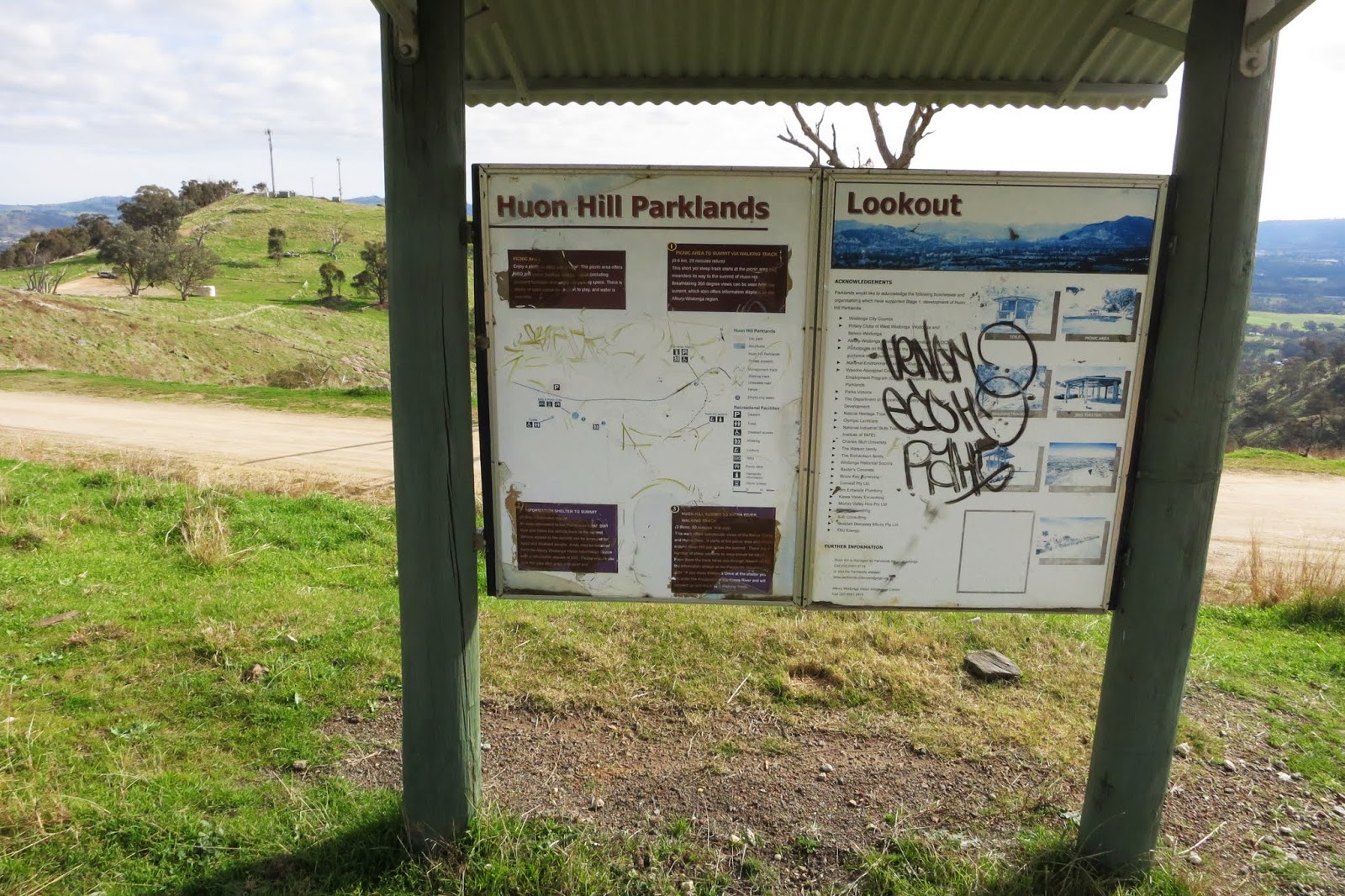
Arrived at the Huon Hill reserve. The signs could do with updating, worn and tatty.
Some good views out to Albury
Also good views to Hume Weir
The road goes up to a lookout then on to the summit trig, the lookout was actually the SOTA summit on my GPS.
The SOTA lookout
Just near the lookout was a stump and log. Strapped the squid pole to the stump and used the log as a radio desk.
Strung out the 40m dipole out to a couple of rocks.
Worked 18 stations on 40m, including S2S contacts with VK3ZPF/VK3YY, VK3WAM, VK3FDTJ and VK3MRG. As I was packing up a fellow ham came up, VK2PSW, Peter who had a dual HT and had come up to try it out. I told him about SOTA so may have a convert... Left for next activation, Mt Major
First day drove down to Huon Hill, a SOTA peak close to Wodonga.
Arrived at the Huon Hill reserve. The signs could do with updating, worn and tatty.
Some good views out to Albury
Also good views to Hume Weir
The road goes up to a lookout then on to the summit trig, the lookout was actually the SOTA summit on my GPS.
The SOTA lookout
Just near the lookout was a stump and log. Strapped the squid pole to the stump and used the log as a radio desk.
Strung out the 40m dipole out to a couple of rocks.
Worked 18 stations on 40m, including S2S contacts with VK3ZPF/VK3YY, VK3WAM, VK3FDTJ and VK3MRG. As I was packing up a fellow ham came up, VK2PSW, Peter who had a dual HT and had come up to try it out. I told him about SOTA so may have a convert... Left for next activation, Mt Major
Subscribe to:
Posts (Atom)