Showing posts with label VK2. Show all posts

Tuesday, 3 May 2022

SOTA Mt Wee Jasper VK2/ST-017

After activating Wee Jasper Nature Reserve, VKFF-2017, decided to go on and activate SOTA summit Mt Wee Jasper VK2/ST-017. Drove along Wee Jasper Rd, turning off to the left onto Wee Jasper Forest Rd. Then turned off to the left onto Pheasant Creek Rd. This used to take you through a dense pine forest. Not any more... most of the pine forest was now cleared. In fact could even see Mt Wee Jasper in the distance ahead.


Took the road on the left running around the side of Mt Wee Jasper. At the end of the road an area to turn, and a track marker for the Hume and Hovell walking track. Parked here.


After a short distance through the pines and into native forest.


Climbed along the walking track to the summit. Fairly steep but did not take long, around 15 minutes or so. Summit of Mt Wee Jasper at 1121 m.


Opposite the trig a couple of handy seats.


Set up the squid pole and radio on one of the seats and sat down to operate.


Got on 40m. Good mobile coverage so spotted myself on 7.090. Worked

VK7KPC, VK3SQ, VK2IO

A summit to summit with VK1DA/4 Andrew on VK4/SE-039 Kluvers Lookout. Weak but workable.

VK3GTV, VK5IS, VK3PF, VK5PAS, VK4NH, VK1AD

A surprising call from G0VWP, Terry in England on 40m... A good 4 by 4 signal.

VK3PMV, VK2CPO, VK3ADH, VK5AYL

Another summit to summit, with ZL4NVW Matt on ZL3/OT-413, weak but workable.

VK2CPH.

Packed up as getting cold and still some driving to do. Drove to Wee Jasper, then back to Canberra via Mountain Creek Rd, Fairlight Rd and Uriarra Rd. Got home about 6pm.

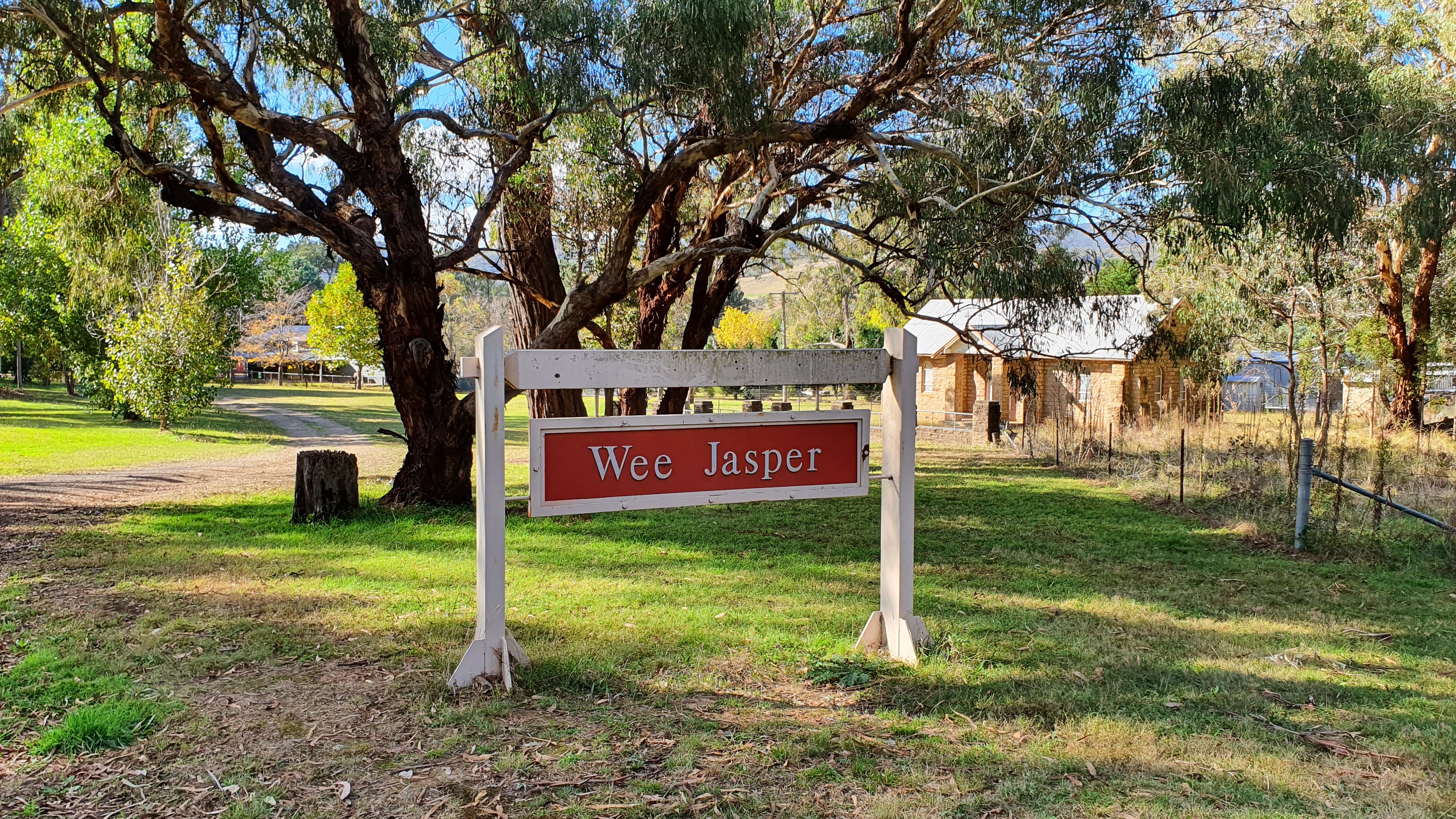


Wee Jasper Nature Reserve VKFF-2017

With a nice sunny day and a forecast of rain in the next few days decided to go out and activate a park. Wanted to go to a park I've not yet activated, Wee Jasper Nature Reserve, VKFF-2017. Drove to Yass first to fill up with cheapish fuel, then on to Wee Jasper. Stopped on the Southern outskirts of the village. 


On the map was marked the Hume and Hovell walking track, which runs through the Nature Reserve. At first could not see it, there was only a fence for the local rubbish tip... Then spotted the markers for the track, running down a path between the tip and a nearby farm fence.

Followed the path, with more track markers. At the back of the tip it followed the fence line of the farm. Disturbed a group of cows relaxing near some car wrecks...
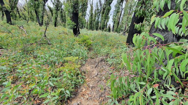
The track eventually passed the farm and headed into Wee Jasper Nature Reserve. Walked in around 700m, following a dry creek for a while, then started climbing. As had good mobile coverage decided to set up in the bush off the track. Used a tree stump for squid pole mast support.


Operating spot. Map from Google Maps


Checked the antenna for resonance on 40m. A bit low in the band on 7.035 Mhz but fairly flat SWR across the band.

Radio on a nearby log, also a seat.

Got on 7.144 Mhz, just in time to hear VK4SMA/p Mark making final calls from park VKFF-1190 Bellthorpe National Park. Worked him for a park to park. After he went clear called CQ parks on 7.144 and got several hunters calling, most good strong signals.

VK3BBB, VK2CCP, VK2IO, VK3CA, VK7QP, VK4KC, VK4MAD, VK4DOG, VK3PF, VK3SQ, VK3MTT, VK5PAS, VK3ZLP, VK2VW, VK2HFI, VK3FIMD, VK5FANA.

Packed up and walked back to the car. As in the area decided to go activate SOTA summit Mt Wee Jasper, VK2/ST-017 next.


Monday, 25 April 2022

Turallo Nature Reserve VKFF-2750

With several stations out portable on Anzac day decided to also go out and activate a park. Returned to Turallo Nature Reserve, VKFF-2750 as only needed a few more contacts to reach 44 for a WWFF point.

Drove to Bungendore, then headed South on Ellendon St, which becomes Hoskinstown Rd as you leave town. The park is grassland on the right as you head South. Parked and walked through a gap in the fence into the park.

As per other activations used a park sign for squid pole support, with dipole ends tied to the nearby fence.

A quick check of the SWR using the Rig Expert Stick analyser, resonant close to 7.144 at 7.175Mhz, good to go.


Shack on the table.


Got on 40m. Band quite good. Started by chasing other parks first for park to park contacts

VK3TKK, AX3TKK Peter in VKFF-0972 Macedon Regional Park

AX3DL Dean inVKFF-2397 Mount Erip Flora Reserve

VK1ACE Rod on SOTA summit  VK2/SM-093 Livingstone Hill

VK2YK/5 Adam in VKFF-1683 Anstey Hill Recreation Park

Spotted myself on Parksnpeaks and got a steady stream of park hunters.

VK3FD, VK2IO, VK2LP, VK2EMS, VK2APC, VK3BBB, VK2CCP, VK2MET, VK1RF, VK2YAK, VK4YAK, VK2OKR,VK4KC, VK4MAD, VK4DOG, ZL1BQD, VK3ZPF, AX5PAS,VK4SMA, VK3CRG, VK3DEB, ZM1BQD, VK3CA, VK3GL/P, VK3VIN, VK3PF, VK2MI, VK7QP

Another park to park with VK2YK/5 Adam in a new park, VKFF-0867 Angove Conservation Park

VK5FBIC, VK3GJG, Vk2IJS, VK5HS, AX5HS, VK3ADH

By mid afternoon the weather had become quite overcast and looked ready to rain, so packed up and headed home.


Sunday, 17 April 2022

Ulandra Nature Reserve VKFF-2009

After spending the Easter long weekend at Junee headed home to Canberra, on the way home stopped to activate a park, Ulandra Nature Reserve VKFF-2009. This is located near the locality of Bethungra.

Heading East, just before Bethungra, Burley Griffin Way turns to the North East, just before crossing a railway line. If you continue straight ahead to the East on a dirt road, Mahomets Road, you will reach a locked gate and the entrance to Ulandra Nature Reserve. Parked just before the gate. There is a side gate for pedestrians.


 Sign for the park just after the gate.

The track is Eulolo Trail

It was warm in the sun... Walked for a while up the hill looking for a suitable shady spot to operate from, stopped on the top of the hill where there was a shady area on the right.

Attached the squid pole to an old tree stump, where there was also a nearby log to sit on.


Operating spot. From Google Maps satellite view

Shack on the ground near the log seat

Got on 40m. First worked a couple of park to parks, VK2PCT Paul in VKFF-0558 Yellomundee Regional Park. Then VK2YAK Gavin in VKFF-2697 Pambalong Nature Reserve.

Able to spot myself on Parksnpeaks okay on 7.150. Conditions good. Worked

VK2BYF, VK2MOE, VK3BBB, VK2CCP, VK3ZPF, VK3JW, VK4SMA, VK5HAA, VK3ADH, VK2VH, VK4AAC, VK3ELH, VK3CA

Another park to park with VK3PF, Peter in VKFF-2200 Sweetwater Creek Nature Conservation Reserve.

VK3MCK, VK3MTT, VK3UCD.

My battery was getting low, so packed up. Headed home to Canberra.


Friday, 15 April 2022

Ingalba Nature Reserve VKFF-1940

While stopping at Junee over the Easter long weekend decided to activate a couple of parks close by. The first was Ingalba Nature Reserve, VKFF-1940. This is located about 8 Km West of Temora off Burley Griffin Way. There appear to be 3 tracks into the reserve, I took the one closest to Temora as seemed to be the most used. Sign for the park


After a short drive spotted a suitable stump for attaching the squid pole to. Satellite map of the operating spot, taken from Google Maps. The track is known as Entrance trail.


Station, squid pole mounted on a tree stump


Shack on the tarp


There were some mosquitoes around, but had some Rid repellant for protection.
Got on 40m. Found the band fairly quiet, suspect a CME had wiped out a lot of the close by signals, as most were distant.

Found VK2YK Adam activating a silo, VK-MGL5, Magill silo, weak but workable.

Had good mobile coverage here so able to spot on Parksnpeaks. Worked on 40m

ZL1BQD,
VK2VW, VK2HFI
VK3BBB, VK2CCP
VK3PF
VK5FANA
VK4KC, VK4MAD, VK4DOG

As had another park to do nearby, Combaning SCA ,VKFF-1305, packed up and headed off to this park. Sorry forgot to take photos so no blog for this park.


Thursday, 14 April 2022

SIOTA - Harden Silo VK-HRN2

While travelling to Harden for the Easter long weekend, stopped at Harden to do a Silo activation. SIOTA, or Silos on the Air is a fairly new portable radio activity, requiring getting in a 1 Km radius of a Silo and activating it on the radio. The ACT where I live has no Silos... so something new for me.

Found the Harden silo easily enough off Albury St, the main street of Harden. This Silo is painted with  silo art. The SIOTA reference is VK-HRN2


A better view of the art from the side street. Note there is a fence, you cannot walk right up to the silo as private property.


Looked for a nearby place to operate from. Just over the road a sports oval, Roberts Park. This was easily in the 1 Km radius of the silo. Map from the Silos on the Air website.

 Set up on the edge of the oval. Dipole tied up to a railing.

Shack on the tarp. Nice but did get warm out in the sun as no shade.


Got on 40m. As expected in a town quite a bit of electrical RF noise, around S7. Probably should have moved...

Spotted myself on ParksnPeaks, worked

VK2IO, VK3PF

VK2HRX/7 Compton on SOTA summit VK7/NE-001

VK2KBB, VK2MOE, VK5FB, VK5HAA, VK5WG, VK3AMO, VK2FW, VK4NH, VK4DXA, VK2NN. Most good strong signals, just as well as had to copy them over the noise.

As getting warn in the sun and travelling with my partner, did not want to spend too long, so packed up and continued driving on to Junee for the Easter break.


Sunday, 20 March 2022

Tinderry Nature Reserve VKFF-2003

Tinderry Nature Reserve is a large park located East of the small village of Michelago, South of Canberra. If you drive the Monaro Hwy between Canberra and Cooma it is very obvious, the Tinderry ranges are high and contain 3 SOTA summits, the highest Tinderry Peak at 1600m. Quite often the range is capped by snow in the winter. Turned off the Monaro Hwy to Michelago, then followed Burra Rd, until reaching Mount Allen Fire Trail. A sign here advising a locked gate 300m ahead, the park boundary. Drove up part of this as quite steep and rocky, parking just past the first hump. The road ahead looked beyond the capabilities of my Xtrail, a proper 4WD needed. After a short walk reached the locked gate and park entry.

Set up the squid pole on the sign and sat the radio and myself on a nearby log. Dipole legs across the road and into the bush.


Operating spot, map from Google Maps


Radio on a nearby log, which served as a seat


Got on 40m. Found 7.144 in use by a park activator so set up on 7.140. Able to spot myself easily as good mobile coverage.

First contact a park to park with VK3BEL Ross in VKFF-0741 Lower Goulburn National Park

The band was quite good with strong signals from both near and far stations. Worked VK2IO, VK3MET, VK3PF, VK2PKT, VK2PEZ, VK4NH, VK4DXA, VK2LX, VK2ACK, VK3GJG, VK4SMA, VK3ZPF.

Another park to park with VK4KC Marty in  VKFF-1643 Sheep Station Creek Conservation Park, along with VK4EMP Mark.

Went on to work VK4CZ, VK3SMW, VK5MAZ, VK3JW, VK2APC, VK2LP, VK2EMS, VK5PAS, VK2VH, VK4AAC/2.

Another park to park with VK4MUD John in VKFF-1195 Expedition National Park

Went on to work VK4HMI, VK4SYD and VK3ZK. 

During the activation was attacked by mosquitoes, really quite bad here. Rather surprised as high up on a rocky hill with no creek, guess just from all the rain recently.

Also while operating 4 motorbikes went past. They looked a bit nervous seeing me, the park sign shows no motorbikes allowed, authorised vehicles only...


Had enough of the mosquitos, packed up and headed home to Canberra.


Sunday, 23 January 2022

SOTA Attempted activation of Mt Palerang VK2-ST-009 and activation of South Black Range VK2/ST-006

SOTA summit Mt Palerang VK2/ST-009 had not been activated since 2017, before the 2019/2020 bushfires, so decided to take a look and see what happened to it.

Drove to Queanbeyan, then Captains Flat Rd, turning off for Hoskinstown and Forbes Creek. Continued along the Mulloon Fire Trail until reaching Mulloon Creek.


There was a fair amount of water flowing so got out to take a look. It looked quite deep on the right so crossed staying well to the left, got over okay.

Stopped at the Mulloon Creek camping area on the other side. It looked good for camping. Note you need to book if you want to camp now.


Continued on the Mulloon Fire trail. Seemed a lot rougher than last time I drove it, with a few washed out spots to take slowly. Reached the 4 way junction with Palerang Fire trail and parked.


The track on the right was not obvious, lots of damage and regrowth, so just headed into the scrub roughly where I remembered it was.

I did find remnants of the track, now much overgrown. Lots of small gum saplings covering the ground.

Climbed up the first steep incline. The gum tree saplings were quite thick and tall now... Guess from all the rain we have had lately. Thinned out a bit when getting to the rocky outcrops. The track came and went.


After about an hour I could see had only got about half way up, and could see rain approaching. Decided not the best day to attempt it and aborted, turning back. Track log taken from my Garmin watch on Garmin Connect. I made it to about 1100m, still had over 100m of steep climbing and bush bashing to go to the summit at 1200m.


To make the drive out worth it, drove back along the Mulloon Firetrail and turned off to activate South Black Range summit, VK2/ST-006. Luckily the weather was a bit drier there. Set up near the big rock with the trig on top


Shack on a rock near a stump supporting the squid pole


Got on 40m and worked VK2IO/p Gerard on VK2/SY-001 Canoelands, also VKFF-0307 with a good signal. Then worked VK1AD/p Andrew on VK2/ST-005 Webbs Ridge with a good signal too.

Then worked VK1MA Matt, quite low down. Switched to 2m FM and worked Matt easily... Also worked VK1MCW/p Bill on VK1/AC-043 Mt Stromlo, and VK1AD/p Andrew on VK2/ST-005 Webbs Ridge again.

Tried a few more calls on 40m with no takers, band seemed to have died. Packed up and headed home. 


Monday, 22 November 2021

SOTA Mt Gillamatong VK2/ST-034

When Andrew VK1AD and Andrew VK1DA announced they were going to activate Big Badja Hill VK2/SM-059, and Bald Mountain VK2/SM-052, thought I would try for an S2S from a close by mountain, Mt Gillamatong VK2/ST-034. This is located near Braidwood and should have a clear line of sight to these 2 mountains to the South.

The drive to Braidwood was uneventful, although did get some spots of rain on the way, so knew could be a damp activation. Approached Mt Gillamatong along Gillamatong Lane.


At the end of Gillamatong Lane a small car park with an unlocked gate.


Up the hill, then headed to the right and up. Walked through the long grass, getting fairly wet feet... 


At the top a small foot gate


Went to the left after the gate for a while, finding a hole in a fallen down fence and then headed up the mountain through the scrub. Lots of thistles... managed to avoid the worst by following the rocks.


Reached the top. Guess should have expected it on a work day, there were a couple of workers near the trig, cutting and clearing away tree branches, probably for improving radio reception up there. I didnt want to get in their way, so set up in the bush just behind one of the compounds. Still well within the activation zone, almost at the same altitude as the trig anyway. Set up just the 2m Jpole on the squid pole.


Shack on the tarp. Running 40w on 2m SSB.


Got on 2m SSB just before UTC rollover at 10:45am. Surprisingly heard Compton VK2HRX/p on VK2/IL-003, Mt Wanganderry. This is around 135 km away to the North... Not real strong but easy copy. Also worked Matt VK1MA.

After rollover worked lots of activators and chasers

VK1MBE Andrew on VK2/ST-001 Mt Cowangerong. Real strong, S9+, although expected as only about 30 Km away to the South.

VK2HRX again post rollover on VK2/IL-003, Mt Wanganderry
VK1MIC, VK1MA
VK1RX/p Al on Mt Stromlo, VK1/AC-043 70 Km away. Quite strong.
VK1AD/2 Andrew on VK2/SM-059 Big Badja Hill, Good S9, about 65 Km to the South
VK2DO Chris operating a remote station down at Batemans Bay, around 45 Km away
VK1DA/2 Andrew on VK2/SM-052 Bald Mountain, about 55 Km to the South. A huge 59+ signal.

It looked like the rain was headed my way, so packed up and headed down the hill to Braidwood for lunch at the bakery.