Friday 31 October 2014

SOTA Activation Cabbage Tree Fire Trail

VK2/ST-035 is a high point in Monga National Park, below Clyde Mountain between Braidwood and Batemans Bay. I identified it while surveying the South Coast summits, and named it after the fire trail I thought it was on as it doesn't have a proper name on maps. This proved to be wrong as you will see later... It was activated previously by Al VK1RX who advised it as fairly easy, so gave it a try.

Drove to Braidwood, then headed down the Kings Highway towards Batemans Bay. Turned off at Misty Mountain road on the right. For Canberra drivers this is just past Government bend, after the road levels levels out for a while before dropping again.


The road is unsealed but suitable for 2WDs, providing not too wet. Note the reference to the "Corn Trail", which is an old historic track from the tablelands to the coast. I have walked this track, it runs from River Forest Road above dropping down to the Buckenbowra River. Lots of lush rainforest and very steep...The idea is to have a car waiting at the end to pick you up, hence the sign.


The road drops down and crosses Sugarloaf Creek


Stopped for a brief look at the creek, some nice rain forest, looking downstream


Looking upstream


Continued on, climbing up the mountain. After 20 minutes drive from the highway reached the junction with Cabbage Tree Fire Trail


Looking down the trail, looked steep...probably need a good 4WD if you want to try it.


Parked just near the junction. At this point only about 250 m from the summit and about 40 m below it. Entered the bush just opposite the junction.


The bush wasn't that thick, easy going between the trees.


I would not advise going too far South, looked a lot thicker. A tall tree fern.


Just before the summit an open forest grove


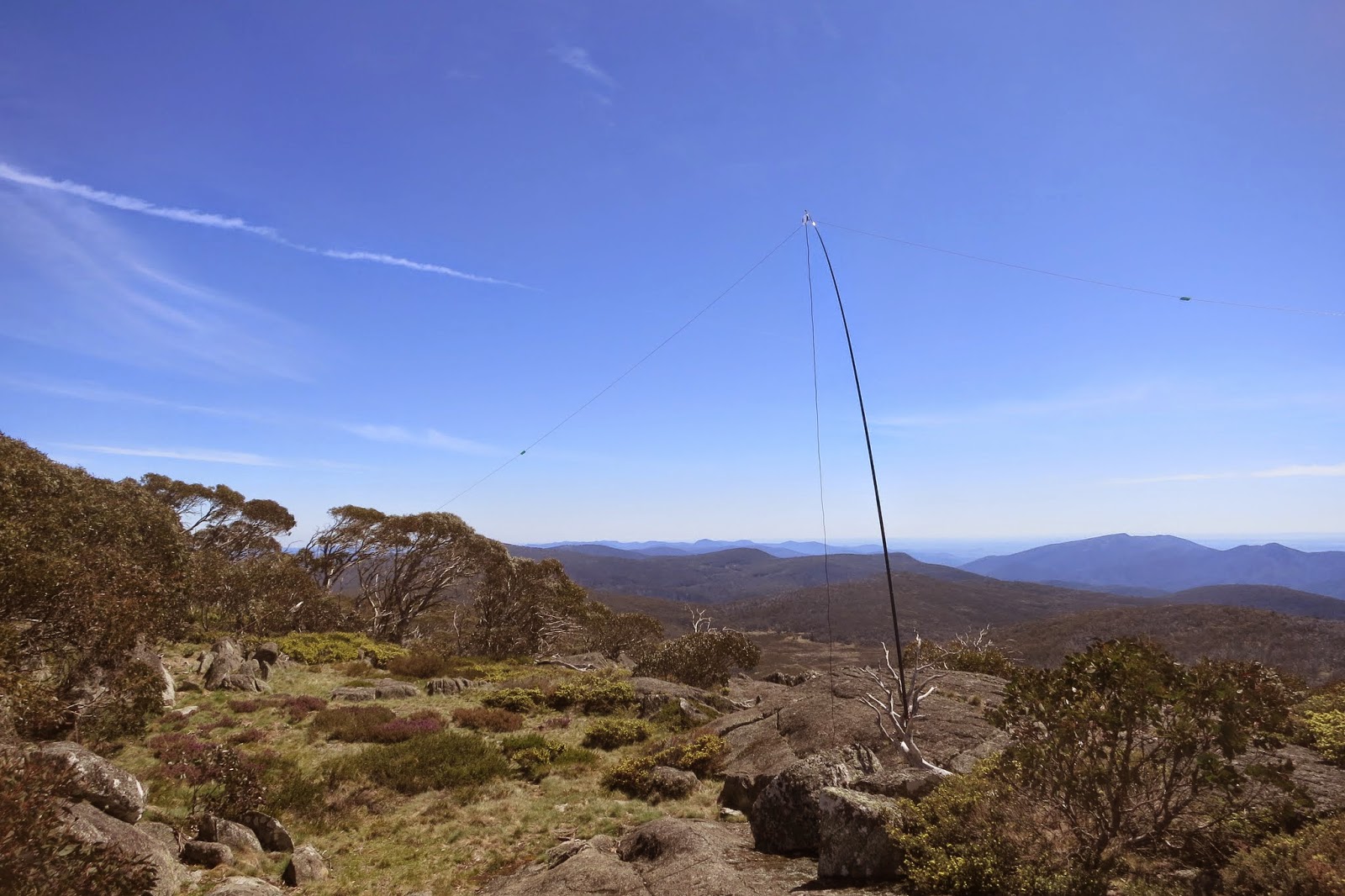
Reached the summit after about a 5 minute walk, a large flat activation zone, plenty of old stumps for squid pole support as this used to be Buckenbowra State Forest and was logged in the past. Used one of the stumps.


Shack at the base on the tarp


Got on 40 m, signals quite good from VK2 and VK3, although lots of QSB. Started a small pileup as I had got on air only 20 minutes before UTC rollover. Contacts with both VK3CAT Tony mobile in Melbourne and VK3PF mobile in Gippland on the way to a summit. Worked the same chasers again post UTC. Tried 20 m, only one contact, VK5WG Nev. I could hear some US activity on 12 m, so gave it a try, but no luck. 24 contacts all together.

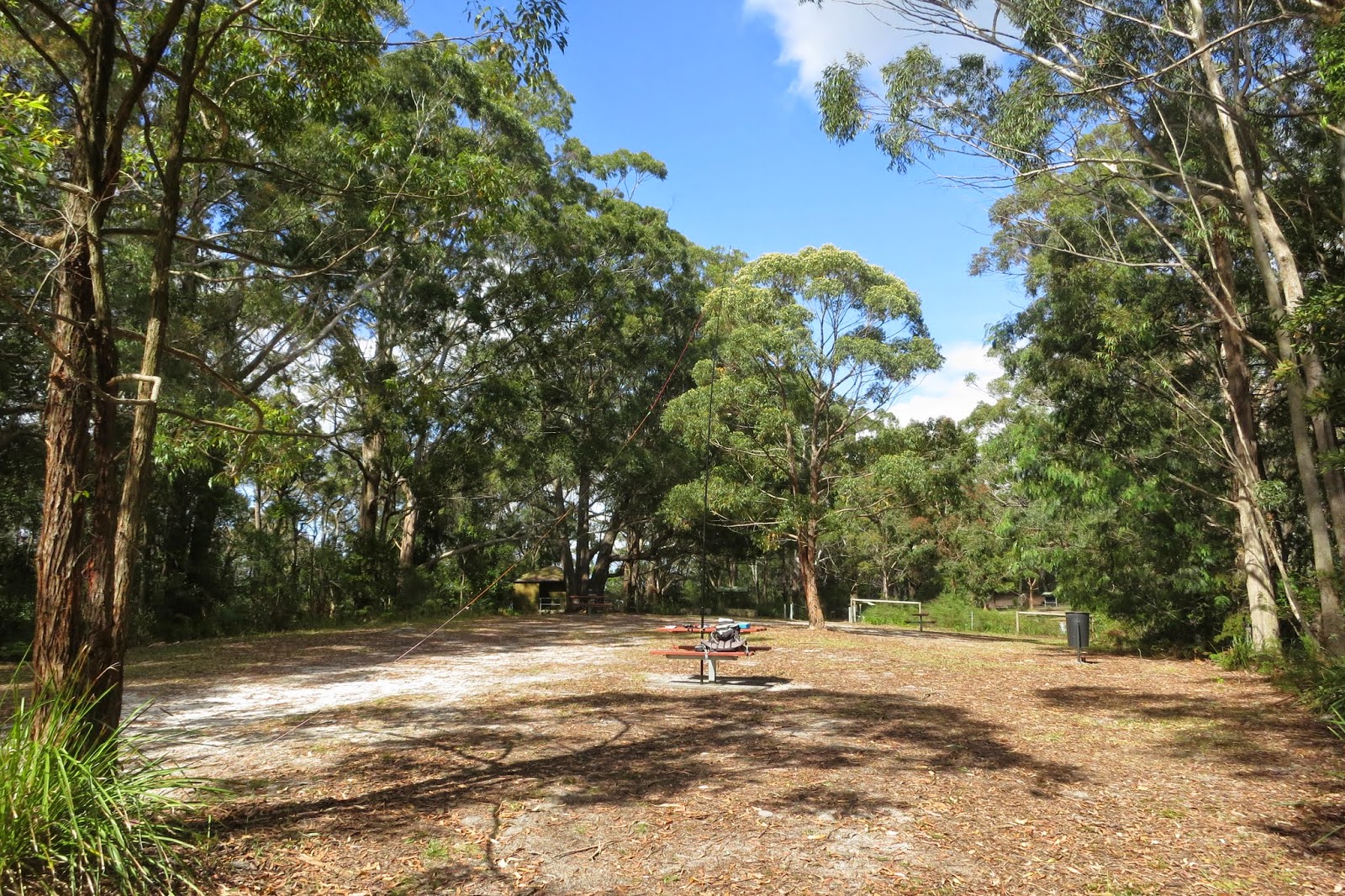
As the weather was starting to get warm and the wind picking up packed up at noon, and headed for the Braidwood bakery for lunch :)

Track log of walk, Monga 1:25k map. Misty Mountain Road, Cabbage Tree Fire Trail, even the Corn Trail all marked.


Track log on Google Maps. Zooming in on the road, it was labelled as Cabbage Tree Fire Trail, which I supposedly followed up to the summit? Misty Mountain Road does not exist! Do not rely on Google Maps for minor forest roads, use a decent topo map.


Tuesday 28 October 2014

SOTA 5000 point Chaser and Mountain Hunter Silver Awards

I recently reached 5000 SOTA chaser points, ie 5 shack sloths level :)

Here is the award


The next chaser award level is 10000 points, this may take a while...

As mentioned in a previous blog I worked a 2nd VK7 summit activation, giving me 10 associations worked, with 2 different continents, so could claim SOTA Mountain Hunter (Silver) award.

Here is this award


Sunday 26 October 2014

SOTA Mt Gingera by mountain bike

With a forecast top of 29 c for Canberra and only 21 c for Mt Ginini decided a good day to activate VK1/AC-002, Mt Gingera. At 1855 m it is the 2nd highest in the ACT and a 10 pointer.

Set off from home. First obstacle was a bike race, hundreds of bikes on Uriarra Road from Uriarra crossing to the Brindabella Road junction. Crawled along behind groups until safe to overtake, lost a lot of time on the drive up. Headed up to the Mt Franklin Road, followed this to the locked gate and car park at the start of the walk.

As I have found the 4 Km road bash from the gate to Priors Hut a bit boring, decided to take my mountain bike this time.


The bike is a 24 speed "Giant" brand. Put on my pack as normal with the squid pole in the side pocket and started riding. Stopped to sign the walks register.


Noticed road was being upgraded with new drains, probably graded too as not too rough. Quite a steep quick descent to about 2 Km from the gate, then uphill, where I went back to walking...
Reached the stockyard spur track junction.


From here fairly level so able to ride a bit more. Got to Priors Hut in half an hour, this is normally about a good hours walk...


I locked the bike up here against a tree, as advised that no mountain bikes can be ridden past Priors hut. After about a Km walk reached the track to Mt Gingera, marked by a post with a blue rock on it


The blue rock...


The track head up to Mt Gingera. Just near the top took a short cut directly up to the summit


Mt Gingera summit. The trig pole looked a bit angled, didn't use it this time for squid pole support


Instead used a dead snow gum nearby


Shack at the base. A little bit of shade for the radio here,


Rucksack Radio Tool on the phone, which had only started working near the summit, reported Andrew VK1DA/P on Mt Coree, VK1/AC-023. Quickly got on air to work him. I then realized I hadn't tied the dipole legs up after laying them out! He was still a good S9...Tied up the ends. One leg tied to a well photographed snow gum near the summit.


Stunning views here. Looking South into the snowy mountains. The ACTs highest mountain, Bimberi Peak, VK1/AC-001 visible.


Returned to 40 m and a large pileup of chasers. Some more S2S contacts with VK3EK/P on VK3/VG-030, VK3PF/P on VK3/VT-046, VK3TCX on VK3/VG-049. 14 contacts before UTC and 14 more after.

Tried 20 m, there was the CQ WW DX contest on, the band was full of strong contest stations running high power...Managed to find a fairly quiet spot, worked VK5PAS Paul and VK5WG Nev.

Tried 2 m FM. worked Paul VK1ATP, and John VK2VEX at Yass with good signals.

Approaching noon starting to get hot with no shade, so packed up and headed back to Priors Hut for lunch in the shade. Rode back. There was a lot more "up" returning so walked a fair bit, took about 45 minutes.

Track log of cycle/ walk


Track profile showing speed and altitude. Due to rocky ground hard to maintain a top speed, best was around 28 km/h


SOTA Mt Ginini

After riding back from Mt Gingera a fairly easy matter to activate VK1/AC-008 Mt Ginini. Drive up, walk down and up the hill again and then set up.

Looking up to the Air Services site.


Looking down the mountain towards Mt Gingera


Set up the squid pole on one of the copper treated logs. A bit windy but managed to secure it okay. Dipole legs flapped about a bit but stayed up. Shack on the tarp.


Started on 2 m FM. Worked VK1NAM/P Andrew and VK1ATP Paul. Went to 40 m, a large pileup of chasers waiting... 18 contacts overall. 20 m no luck. Headed home.


Thursday 23 October 2014

SOTA Mountain Hunter Award - Silver

Following a contact on 20 m with Justin VK7TW activating VK7/SC-006, I now have 2 contacts with the VK7 association. This gives me 10 associations with 2 or more contacts, in 2 continents, and the Mountain Hunter Silver level award :)

Mountain Hunter Award (all bands) Status = Silver

Association(s) Chased All BandsCount
G - England3
OE - Austria3
VK1 - Australia - Capital Territory38
VK2 - Australia - NSW152
VK3 - Australia - Victoria186
VK4 - Australia - Queensland4
VK5 - Australia - South Australia25
VK6 - Australia - WA2
VK7 - Tasmania2
VK8 - Australia - Northern Territory3

Mountain Hunter Award (all bands): associations not yet qualifying

Association(s) Chased All BandsCount
DM - Germany (Low Mountains)1
GW - Wales1
VK9 - Australia - Islands1

Saturday 18 October 2014

SOTA Mt Alexandra

After activating Mt Elliot VK2/HU-093 drove South on the Newcastle Freeway then through Sydney. Fairly hectic with traffic as always. Drove out South on the Hume Highway, turning off at Mittagong.
Drove to the end of Victoria St to the car park and followed the signs to Katoomba Lookout, just down from Mt Alexandra summit.


As per my activation here last September the waratahs were out in flower.


Reached the lookout. Picnic tables here, great for SOTA :)


View of the Hume freeway below. Could hear traffic on it but not too noisy.


Set up the squid pole on one of the tables. Dipole legs tied to trees.


Nice comfy SOTA station on the table. As per last time used a rock between the table and pole as a support.


Got on 40 m. Started with a S2S with VK2BJP/3 on VK3/VE-006. A couple more S2S later, VK2IB/P on VK2/SW-021 and VK3AFW/P on VK3/VC-033. Good strong signals from VK1, VK2 and VK3. 12 contacts. Packed up and drove home after 2 weeks of travelling :)


SOTA Mt Elliot

After activating Middle Brother drove South on the Pacific Highway, past Newcastle, turning off to The Entrance town for the night.

In the morning drove to Mt Elliot. I had worked this summit many times as a chaser and was curious to see what it looked like. It is located at the end of Toomeys Rd in the Gosford suburb of Mt Elliot.
Drove to the end, as pointed out in activators blogs a communications tower and a private house there.


The activation zone is fairly large, and covers Katandra Reserve, with picnic tables. There are some walks here, I took Toomey Walk to walk out of and back into the 25 m activation zone.


Some nice ferny forest. Heading back up to the picnic area.


Set up on one of the picnic tables. Used a rubbish bin stand for one dipole leg


The other end tied to a tree. Plenty of space here.


Shack on the picnic table. Nice and comfy for a change...


Got on 40 m. As a Saturday and now not that far North lots of contacts, from VK1, VK2 and VK3. A S2S with VK2BJP/3 on VK3/VE-007 Mt McKay. Spoke to some of the locals who have activated here, VK2YK Adam ,VK2IO Gerard. This summit has had 30 activations previously so pretty popular...

As had a tough drive through hectic Sydney to get home didn't linger, packed up after 16 contacts.

Friday 17 October 2014

SOTA Middle Brother

After activating North Brother mountain and staying overnight at Laurieton headed South on the Pacific Highway to activate Middle Brother summit. The summit is accessed via Middle Brother National Park.


An update from Gerard VK2IO. The summit is NOT located in Middle Brother National Park, it is in a square section outside the park. So if you want to activate the park as well you will need to activate the summit, move out of the square and activate the park.


It is accessed via TV Road. Unsealed and a little steep in places but okay for 2WD cars.


Parked out of the activation zone and walked up the road to the summit, a cluster of TV transmission towers


Trig point at the summit all locked up...


Dropped back down the road and found a small sapling to support the squid pole. Used a roadside marker post for one leg of the dipole support and a tree branch for the other.


Shack on the tarp just off the road. A little shade.


Got on 40 m. Lots of noise from the nearby towers...Probably should have set up a little further down the road. Anyway made 4 weak noisy contacts with VK3FPSR, VK3EK, VK2WTY and VK3WE.

Tried 20 m, one contact with VK5WG.

My most useful band on the trip, 30 m, yielded 4 more contacts, VK3AFW, VK2JDL, VK2CCJ and VK3YAR with good signals.

Packed up and headed back down to the Pacific Highway, heading South.

As I drove past had a look at the last SOTA peak in the 3 Brother mountains, South Brother. Looked hard, thick vegetation, rocky cliffs, no road access and possibly on private land...gave it a miss.