Saturday 26 October 2013

SOTA Activation VK1/AC-019

SOTA summit VK1/AC-019 is an unnamed summit on the Boboyan Divide, and is the most Southern SOTA peak in the ACT. Drove down through the ACT on the Boboyan Road to the ACT/NSW border.


Just after the border there was a spot to park on the right. Here is the border from the NSW side, where you enter Namadgi National Park.


There is a fire trail on the side here, with a locked gate, but able to get through on foot.


The fire trail climbs steadily up to Burnt Hill. Just before the top was an interesting sign telling the history of surveying the ACT border.


Some views of my destination, VK1/AC-019 on the right, with VK1/AC-014, Mt Clear on the left.


After Burnt Hill the fire trail headed down, and was joined by another fire trail on the NSW side.


The track then climbed upwards, steep in places. After a 6 Km walk reached the SOTA summit. Simply a high point on the fire trail, no trig or cairn.


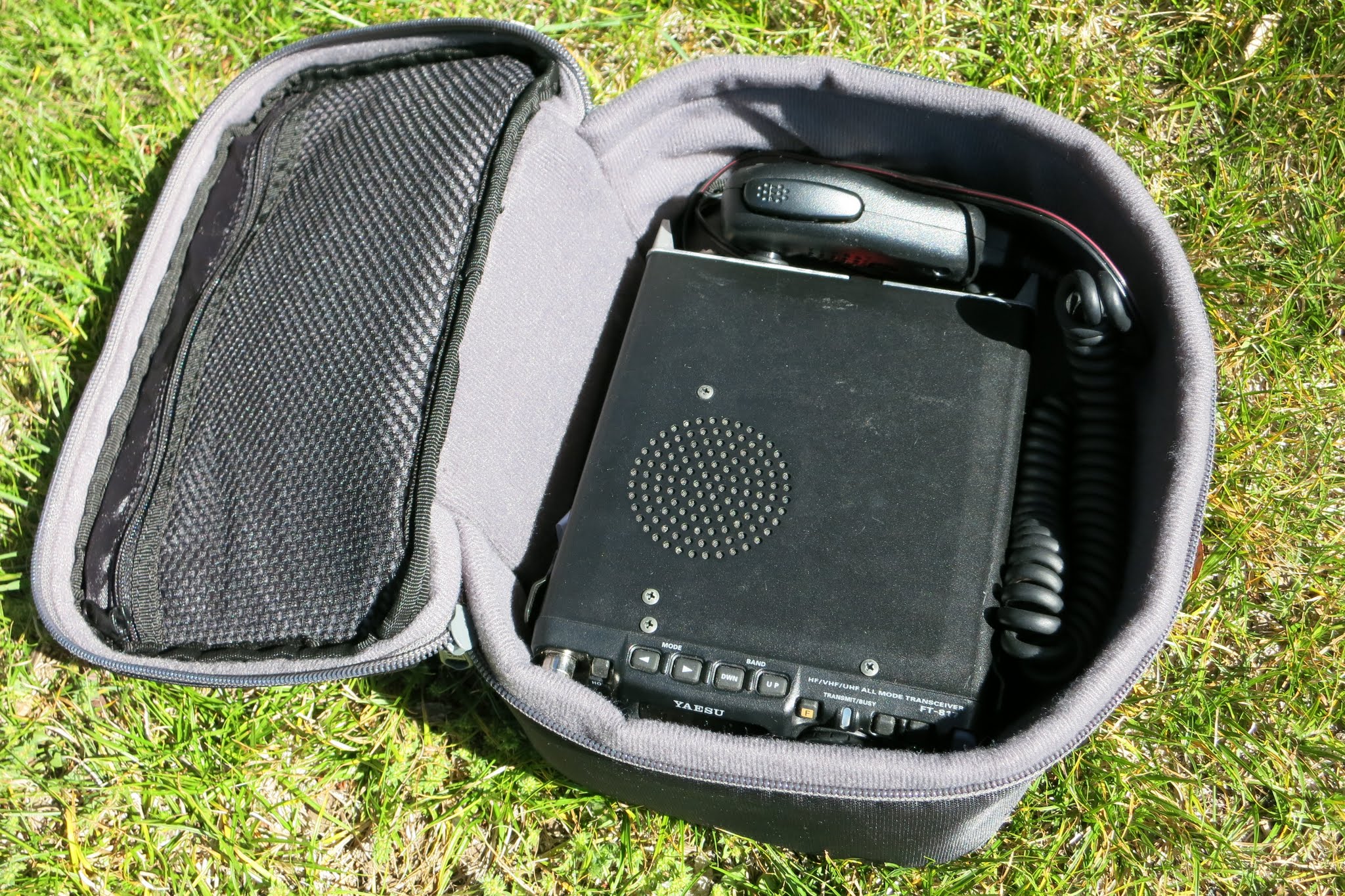
Used a large fence post to support the squid pole, and strung the 40m and 20m dipoles out along the fence, using posts and tree branches for support.


Got on air on 40m and immediately worked Al, VK1RX/2 on Mt Palerang, VK2/ST-009. Then usual chasers, mainly VK1's,VK2's and VK3s. Another S2S with VK2FAJG/P on Mt Kosziusko, VK2/SM-001, Austrailia's highest mountain at 2229m. Pleased to work this summit. Worked Nick VK3ANL/P on VK3/VC-019 and finally Rod, VK2TWR doing his 1st activation on VK2/SM-068, The Peak. I had to wait while he swapped batteries but got a contact made later. Tried 20m but there was a contest on, drowned out by high power contest stations. 22 contacts all up.

Packed up and walked back. Took about an hour and a half to walk there, about an hour and a quarter to get back to the car.

Profile of walk. Climbed about 300m.


Track log of walk


Friday 25 October 2013

SOTA Summit to Summit 500 Points Award

From recent SOTA activations managed to accumulate over 500 chaser points, so applied for the award in the SOTA shop online. Always enjoy making Summit to Suimmit contacts, and will often hang about on summits just to catch up with other activators.

Here it is


Sunday 20 October 2013

10m open again but not as good

Had a listen on 10m JT65 again this morning. Hearing several North American signals but none real strong compared to yesterday. Propagation seemed to favor more to the North with strong Japanese signals.

Anyway managed to work JQ3UDL, NE6H in CA and KF4RWA in AL.

Signals heard over a 12 hour period on pskreporter


Saturday 19 October 2013

10m open to North America and Pacific

After seeing good conditions Thursday while stuck at work :( looked forward to trying 10m on Saturday morning.

The band was fairly active on 28.076 Mhz JT65 mode, my old shack laptop had problems decoding all the signals at times... Here is a plot of stations heard over a 12 hour period.


Good spread of signals from North America and the Pacific. Worked N3GTY in North Carolina, N2LQ in New York and VA3DAZ in Ontario with good signals. Highlight was working YB0MZI/4 Zen in the island of Sumatra, Indonesia. A new country for me on 10m JT65.


Thursday 17 October 2013

10 Metres Open

As well as SOTA one of my other amateur radio interests is chasing DX on 10m JT65. Having read online that 10m has had some good openings lately, decided to leave the radio on 28.076 Mhz while at work for the day.

Here is the result of 12 hours receiving, displayed on Pskreporter


The pink blobs are 10m. As you can see USA, Pacific, Asia and Europe all heard. After getting home from work 10m went quiet, so switched to 15m for a while (orange blobs). Mainly Japanese signals. 15m seemed to quieten down after sunset, so switched back to 10m. Saw OZ1PIF calling so gave him a call and managed to work him, Peter in Denmark, running 25w into a dipole. I run about 30w into a 5 element yagi. Nice to hear the band open again, been ages since I worked Europe on 10m.

Sunday 13 October 2013

SOTA Activation Mt Palerang VK2/ST-009

As part of the VK2 SOTA activity day I chose to activate a nearby summit, VK/ST-009 as I have walked up it before and know what to expect.

Mt Palerang is a lopsided mountain peak visible on the road to Braidwood on the Kings Highway, if fact the council for the Braidwood area is called Palerang Council and have a symbol of the mountain as their logo.

I drove out to Forbes Creek as per my activation of South Black Range and instead of turning off onto the North Black Range fire trail, kept going on the Mulloon Fire trail. This is not too bad for driving on, there is a ford over the Mulloon Creek which can flood, no problem crossing today.


The road eventually comes to a 4 way intersection which is where I parked.


Mulloon Road continues on to Braidwood. On the left is Gourock Range Trail


Palerang Trail is on the right. Walked down this road


About 50m along this road was a foot track on the right, heading up the ridge, took this track.


The track climbs steeply up the side of Mt Palerang.


About half way up the track runs out, however the way up is obvious, walk up the rocky ridge line.


After around 45 minutes, having climbed 250m over about a Km, reached the rocky summit trig.


Climbed on top, could possibly have used the trig pole for a support, however there was not much room on the other side for a dipole leg, and the wind was howling...


Looking South to Mt Lowden, VK2/ST-002 where Andrews VK1DA/1NAM were operating.


I went a bit to the North of the trig and used a stump for supporting the squid pole, finding a spot at the base out of the howling wind. Ran 1 leg of the dipole to a tree branch.


The other leg attached to the top of the trig.


The squid pole flopped about in the wind a bit but stayed up.


Got on 40m. Started with a S2S with Jack, VK2AXL on VK2/MN-056. Then the usual pileup of chasers...Some more S2S with VK1DA/1NAM on nearby Mt Lowden, Al VK1RX/2 on nearby Mt Budawang, VK1FB on VK1/AC-002 Mt Gingera, who I also worked on 2m FM, John VK2YW on VK2/RI-031, Wheel Of Fortune. Made a few contacts back into Canberra on the 2m Hand Held.

Worked 23 chasers before UTC changeover. Another 21 more contacts after UTC, however the band appeared to die with at first weak signals then none at all...gave it away around 11:30am and packed up.

On the way home stopped at a picnic area near the Mulloon Creek Ford for lunch, nice spot.


Track log of walk.


Saturday 12 October 2013

SOTA FT817 Case

At the presentation of SOTA at the Goulburn and Southern Highlands club recently noticed Andrew, VK1DA using a Kathmandu camera case to protect his FT817 within his pack. As my FT817 has been simply bundled in a plastic bag thought I would get one too to protect it better.

FT817, power cable and microphone in the case.


I even purchased a 2nd Kathmandu camera case, to carry all my coax. battery and bungy cords!


Wednesday 9 October 2013

SOTA Presentation to Goulburn and Southern Highlands Amateur Radio Society

Andrew VK1NAM received an invitation to do a presentation to the Goulburn and Southern Highlands Amateur Radio Society on SOTA, and invited myself, Al VK1RX and Andrew VK1DA along.

Met up with Andrew VK1NAM and Al VK1RX at the Ainslie Football Club at 6:45pm, where Andrew and Al transferred themselves and SOTA gear to my car and we drove to Goulburn. Goulburn is around 100 Km drive from North Canberra, via the Federal Highway and Hume Highway. Took about an hour, on the way we checked out some potential SOTA peaks on the other side of Lake George...

Arrived at the club meeting venue, the Goulburn Workers Club about 6:45pm, where we caught up with the club president, Chris, VK2EF just arriving. He led us to meet some of the other club members, also Andrew VK1DA who had driven here separately.  Had a nice meal in the club.

Just before 8pm headed upstairs to a meeting room where Andrew set up the presentation. Like the Canberra Club presentation there were technical problems with getting the laptop and projector to talk to each other, however in this case managed to get it working and the presentation started about 6 minutes late.

Here is the Presentation Contents:


Andrew VK1NAM covered the history of SOTA, then Andrew VK1DA as VK2 Association Manager covered SOTA in VK2. I gave a brief description of the VK2 qualifying summits in the local area.

Andrew VK1NAM then spoke about activating, chasing, rules  Gave a live presentation of generating a spot using the phone app to the SOTAWatch website, worked well, even go the goat to bleep!

Al VK1RX gave a talk on how to go about getting access to summits on private property.

We quickly showed our SOTA gear as running behind time. The club members seemed quite interested. Finished off showing our blogs, including mine.

Drove back to the Ainslie Football Club, getting back around 11:00pm, another 10 minutes and I got home.

Think the presentation went well, although was a lot to take in. No doubt will at least get a few more chasers coming up from the club members, might even get some new activators.

Monday 7 October 2013

SOTA Activation Mt Wee Jasper VK2/ST-017

Having a day off work for Labour Day in the ACT, decided to go activate a new peak. Picked Mt Wee Jasper as I had walked up it before several years ago, and remembered it has a walking track to it, the Hume and Hovell Walking Track.

Left home in North Canberra, drove to Wee Jasper via Uriarra Rd, Fairlight Rd, Mountain Creek Rd and Wee Jasper-Yass Rd. After driving through the Wee Jasper followed the road for a further 4Km until arriving at the Fitzpatrick Trackhead camping ground. Being a long weekend was busy with campers.


Drove to a car park at the end of the reserve and started walking. Note the Hume and Howell Walking track runs for over 400Km between Yass and Albury. Track markers show Hume and Hovell walking...


Sign on the track indicating 7.8Km to go to the summit of Mt Wee Jasper. Forgotten it was so far...


After a bit over a Km the track crosses a stile to the left and heads uphill through farmland. A bit annoyed to see I could have actually parked here and saved some walking...


The track climbed steeply up the hill


Headed right following hill contour. Some good views


The track crosses several wooden bridges on the way.


A few Km from the top the track joins a forestry road. May possibly be an easier way up from the end of this road.


After a junction and walk through pines the foot track continues up to Mt Wee Jasper. After almost 3 hours walking reached the summit. Trig and a sign indicating 1121m.


Just behind the top were a couple of seats. I like seats :) Used one for supporting the squid pole and as a radio desk.


FT817 SOTA shack on seat.


Got on 40m, worked John  VK2YW on VK2/RI-002 for a S2S. After moving down to 7.085 worked the pileup...Made another S2S with Scott VK2AET on VK2/NT-051. Also worked Grant VK2GEL in Goobang NP. Made 20 contacts, as not a holiday in VK3 a fairly good number. While on the summit a small brown wallaby came by, got quite close for a photo.


Headed back down the same way. After over 15 Km of walking I was very tired...Next time I'll try to access from a road on the other side instead of the walking track...Seems I climbed about 700m! Track log of walk.